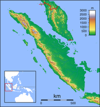
Hang Nadim Airport
From Wikipedia, the free encyclopedia
| Hang Nadim International Airport Bandara Internasional Hang Nadim | |||
|---|---|---|---|
| IATA: BTH – ICAO: WIDD | |||
| Summary | |||
| Airport type | Public | ||
| Serves | Batu Besar, Nongsa, Batam | ||
| Elevation AMSL | 126 ft / 38 m | ||
| Coordinates | 01°07′15″N 104°07′07″E / 1.12083°N 104.11861°E | ||
| Website | |||
| Runways | |||
| Direction | Length | Surface | |
| m | ft | ||
| 04/22 | 4,025 | 13,256 | Asphalt |
| Statistics (2006) | |||
| Passenger movements | 3,300,000 | ||
| Airfreight movements in tonnes | 16,230 | ||
It has been the primary method of transport to and from Batam, alongside ferries to neighboring islands (including Singapore). As Batam continues to develop its tourism sectors, the Hang Nadim has proved a sufficiently effective airport. Originally developed as an alternative airport for Singapore Changi Airport in mind (should in case an emergency for aircraft force a redirect), the Hang Nadim has facilities and the longest runway in Indonesia, sufficient for Boeing 747s and several times more passengers than it is currently serving. However Changi was developed to grow, and the Sijori Growth Triangle region has 5 airports, including Senai International Airport in Johor Bahru, Raja Haji Fisabilillah International Airport in Tanjung Pinang, Bintan Island and the Seletar Airport.
[edit] Airlines and destinations
Airlines | Destinations | Terminal |
|---|---|---|
| Batavia Air | Bandar Lampung, Jakarta-Soekarno Hatta, Medan, Padang, Palembang, Pekanbaru, Pontianak, Surabaya, Yogyakarta | Domestic |
| Firefly | Kuala Lumpur | International |
| Garuda Indonesia | Jakarta-Soekarno Hatta, Surabaya, Medan | Domestic |
| Garuda Indonesia operated by Citilink | Jakarta-Soekarno-Hatta, Surabaya | Domestic |
| Lion Air | Jakarta-Soekarno Hatta, Medan, Pekanbaru, Surabaya | Domestic |
| Merpati Nusantara Airlines | Bandung | Domestic |
| Sriwijaya Air | Jakarta-Soekarno Hatta, Jambi, Medan, Surabaya, Padang | Domestic |
| Sky Aviation | Batam, Tanjung Pinang, Matak, Dumai, Rengat, Pangkal Pinang | Domestic |
[edit] References
- Hang Nadim Badan Pengusahaan Batam Airport Official Site
- Hang Nadim Badan Pengusahaan Batam Airport at Batam Industrial Development Association (BIDA) website
[edit] External links
- Airport information for WIDD at World Aero Data. Data current as of October 2006.
- Current weather for WIDD at NOAA/NWS
- Airport information for BTH / WIDD at Great Circle Mapper.
- Accident history for BTH / WIDD at Aviation Safety Network


Tidak ada komentar:
Posting Komentar